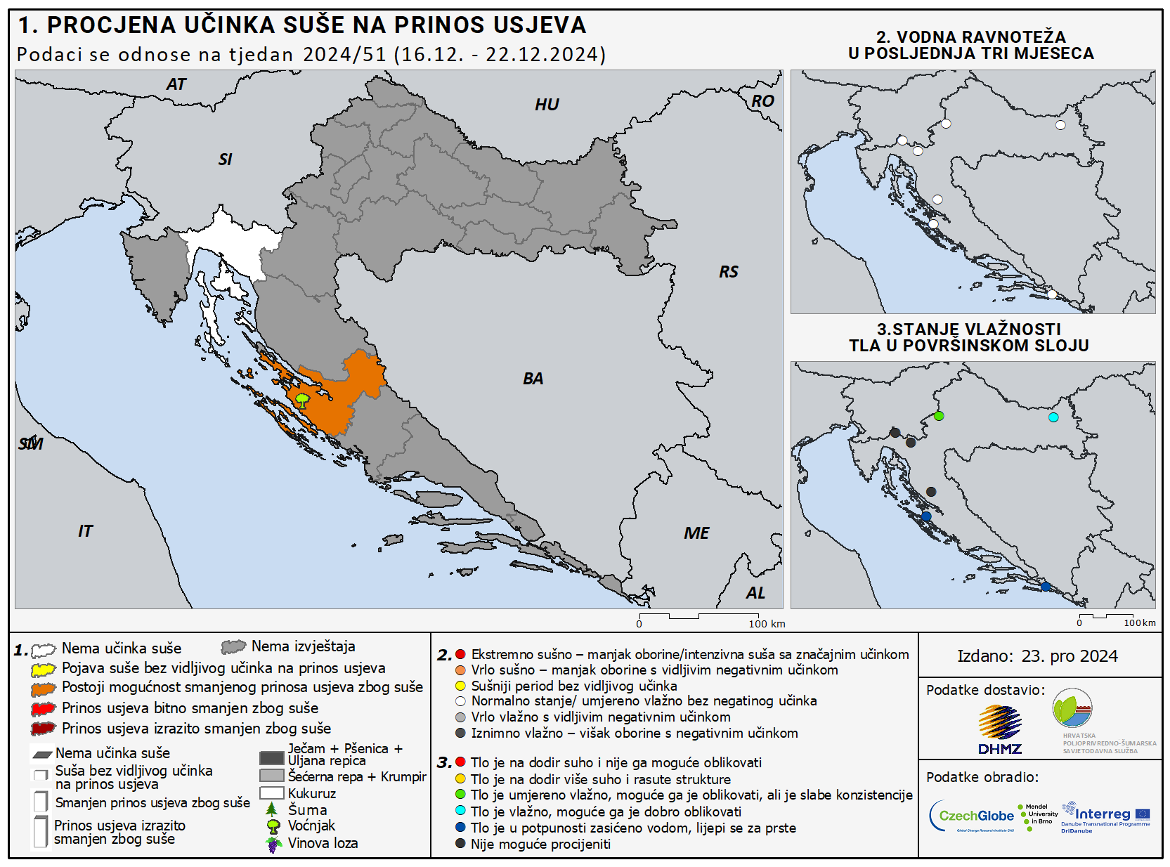
Maps of estimated drought impact on main crop yield, fruits, viticulture, olives and forest – DriDanube project

Map 2. Water balance for the last three months
Map 3. Current soil moisture in the topsoil layer
About maps
Maps are created according to the questionnaires fulfilled by reporters once a week, always at the same location. Reporting is a part of the activities within DriDanube project.
Map 1. presents estimated drought impact on main crop yield, fruits, viticulture, olives and forest in previous week in Croatia. According to the fulfilled questionnaires for each county the mean is calculated and presented on the map according to the following symbology:
 | counties with no report |
 | counties with no drought impact |
 | counties with drought occurrence with/or impact on crop yield |
 | counties where drought occurrence is likely to reduce crop yield |
 | counties where drought occurrence significantly reduces crop yield |
 | counties where drought occurrence substantially reduces crop yield (the worst scenario) |
Pictograms at each county have the following meaning:
 | forest |
 | fruit trees |
 | grapevine |
 | barley, wheat and rape |
 | sugar beet and potatoes |
 | corn |
 | severity of drought impact is presented by different size |
Map 2. presents water balance for the last three months. Each dot on the map belongs to the location for which the questionnaire is fulfilled. The color of dots presents the severity of drought in the following way:
 | extremely humid - precipitation excess with negative impact |
 | very humid - with noticeable negative impact |
 | normal state / moderate humid period without negative impact |
 | rather dry period without noticeable impact |
 | severe drought - precipitation deficit with noticeable negative impact |
 | extreme drought - precipitation deficit/intense drought with significant impact |
Map 3. presents state of soil moisture in the layer 20 cm from the surface at the location for which the questionnaire is fulfilled. The color of dots presents the dryness of soil in the following way:
 | the soil is dry to touch and non-moldable |
 | the soil is rather dry to touch with loose consistence |
 | the soil is slightly moist, moldable with low cohesion |
 | the soil is moist, well moldable |
 | the soil is very wet, sticks to fingers |
 | out of classification scale |
Note: Week number refers to the week when the map was created.