Maps, climate extremes
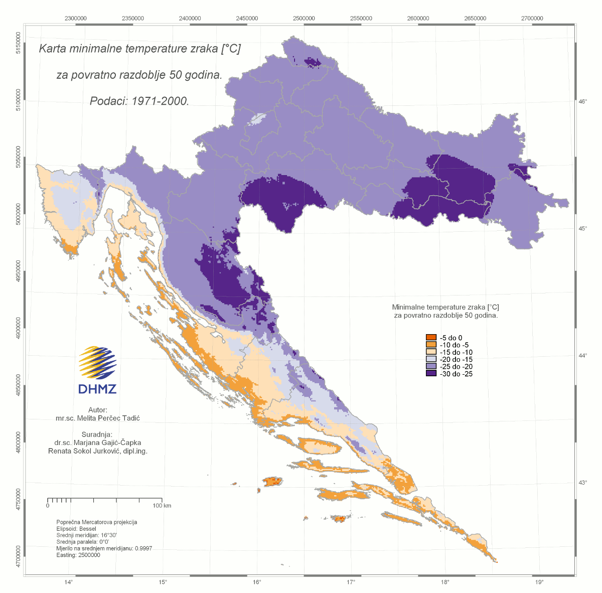
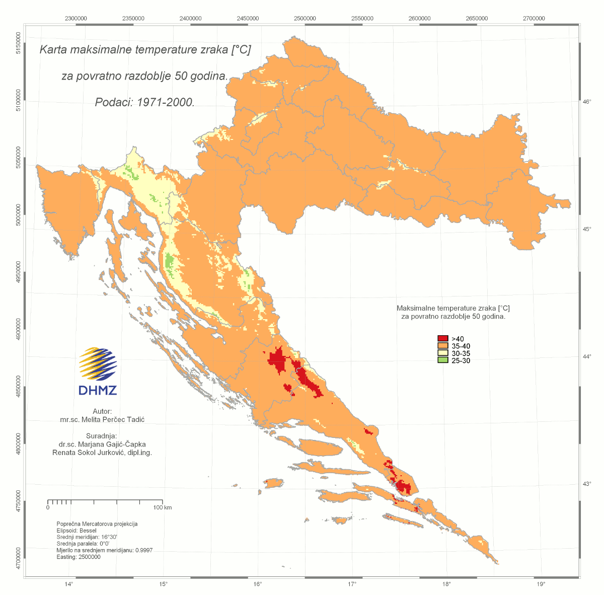
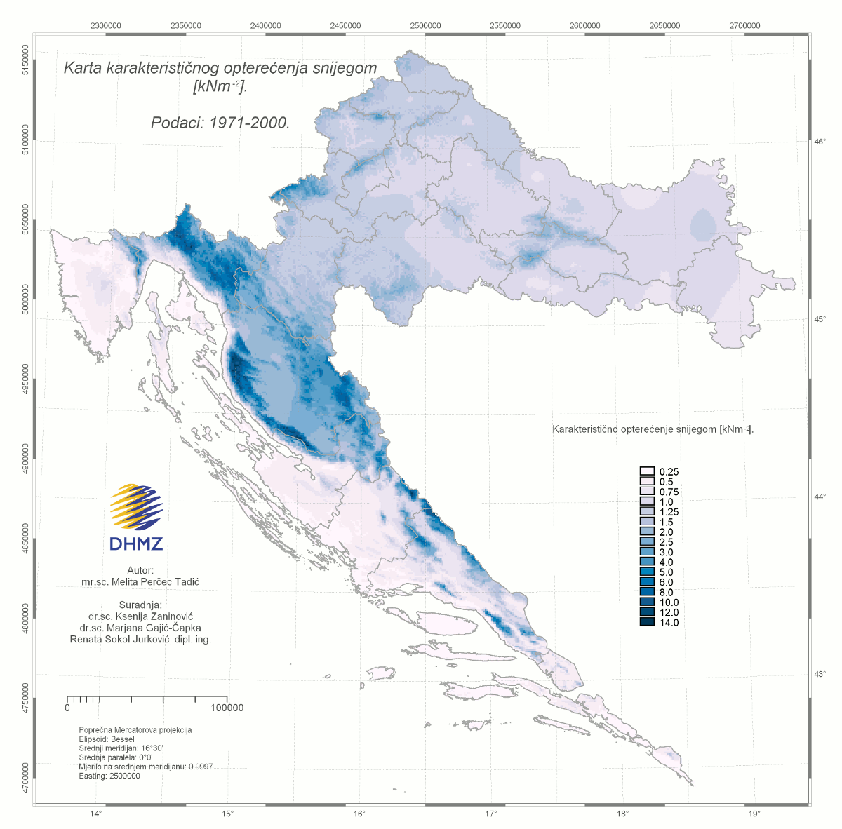
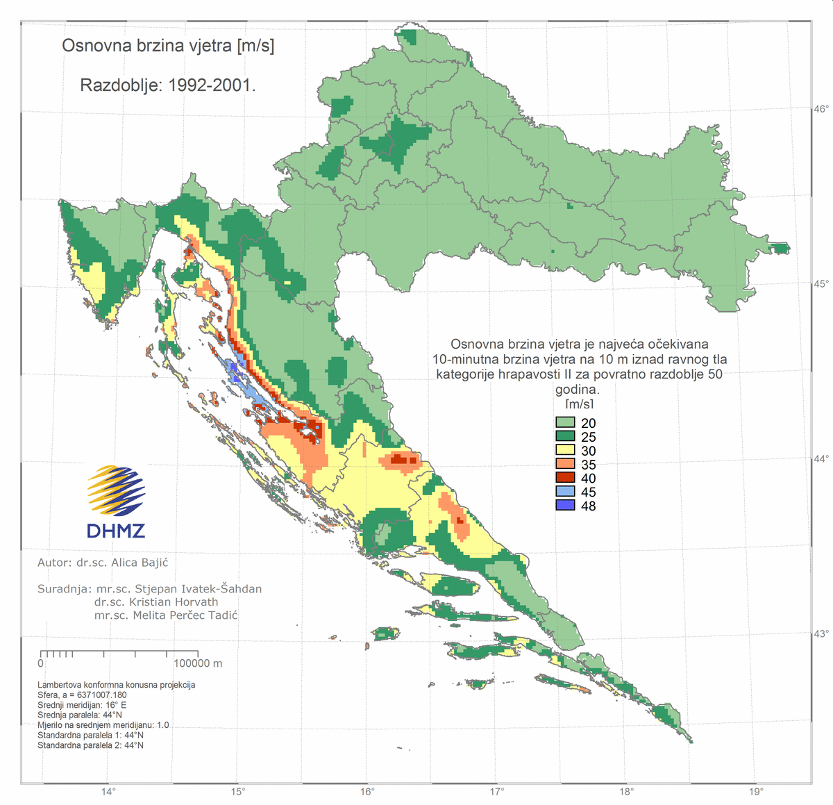
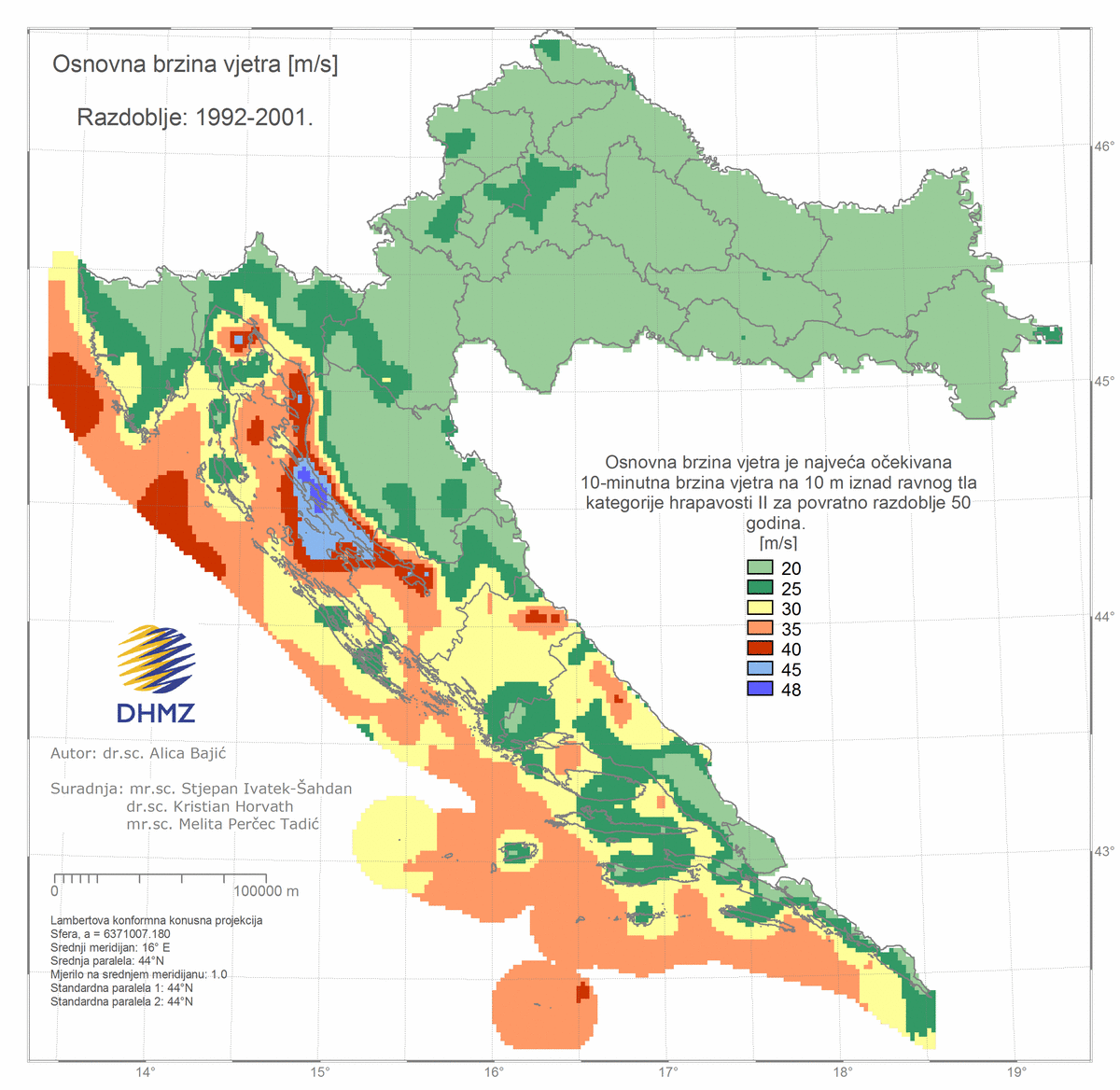
In the applied climatology, especially for the purpose of planning objects with longer lifespan, events that rarely occur are of interest. The minimum and maximum air temperatures for the 50-year returned period, the maximum wind speeds for the 50-year returned period and the characteristic snow load are significant parts of the technical regulation related to the meteorological conditions affecting the buildings.
Since the extreme values of meteorological parameters change over time and spatially, it is recommended to apply the extreme value theory to determine the value of the meteorological extremes for the particular probability of occurrence, i.e. the corresponding return period in climatically different areas. Estimated extreme value for selected return periods T, i.e. values that are likely to be exceeded once in these T years, can be calculated according to the calculated extreme value parameters of the distribution.
The maps presented are part or bases for the national annexes in standards issued by the Croatian Standards Institute:- Wind actions: HRN EN 1991-1-4:2012/NA:2012
- Snow loads: HRN EN 1991-1-3:2012/NA:2012
- Thermal actions: HRN EN 1991-1-5:2012/NA:2012