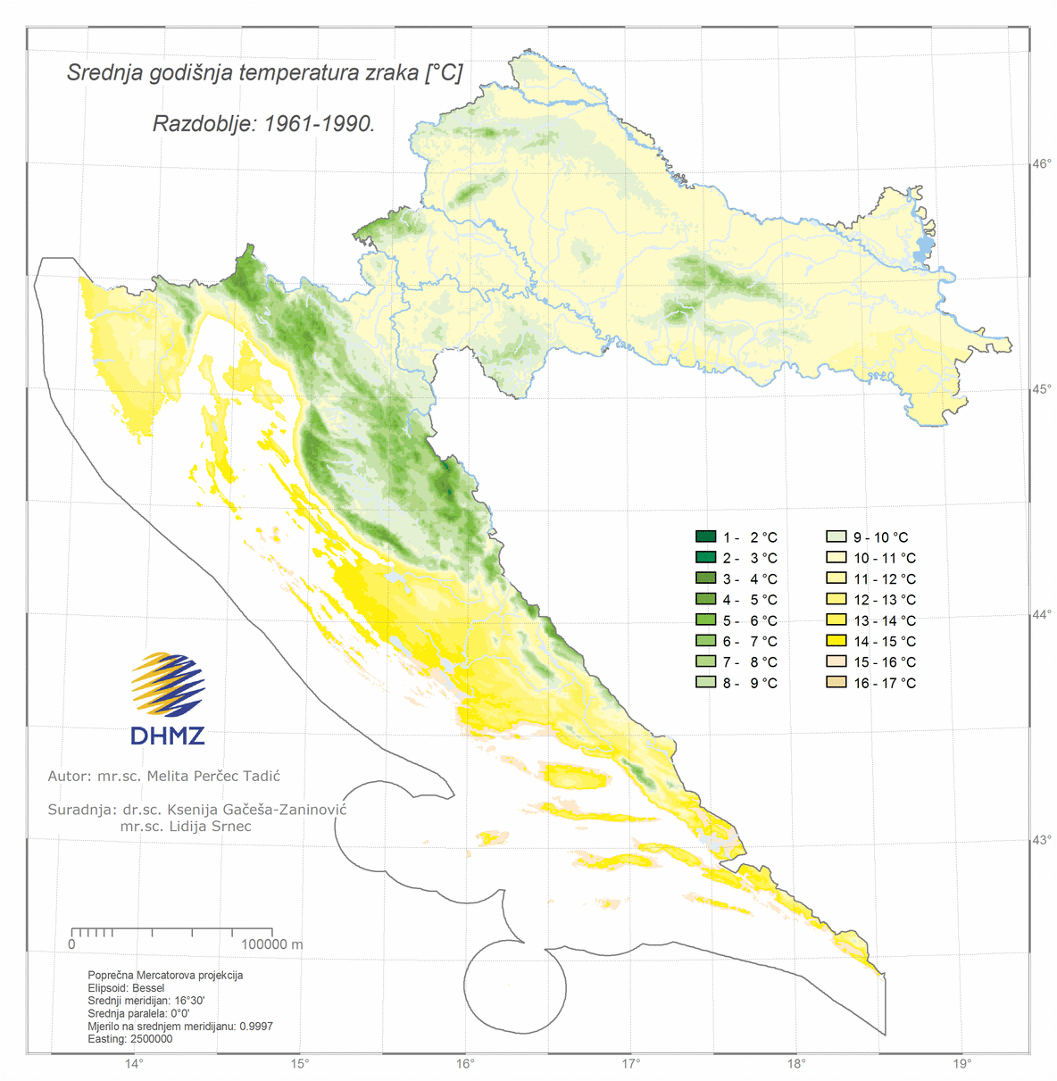
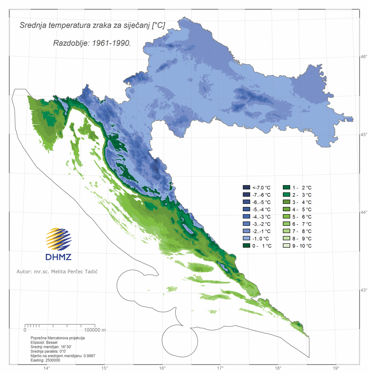
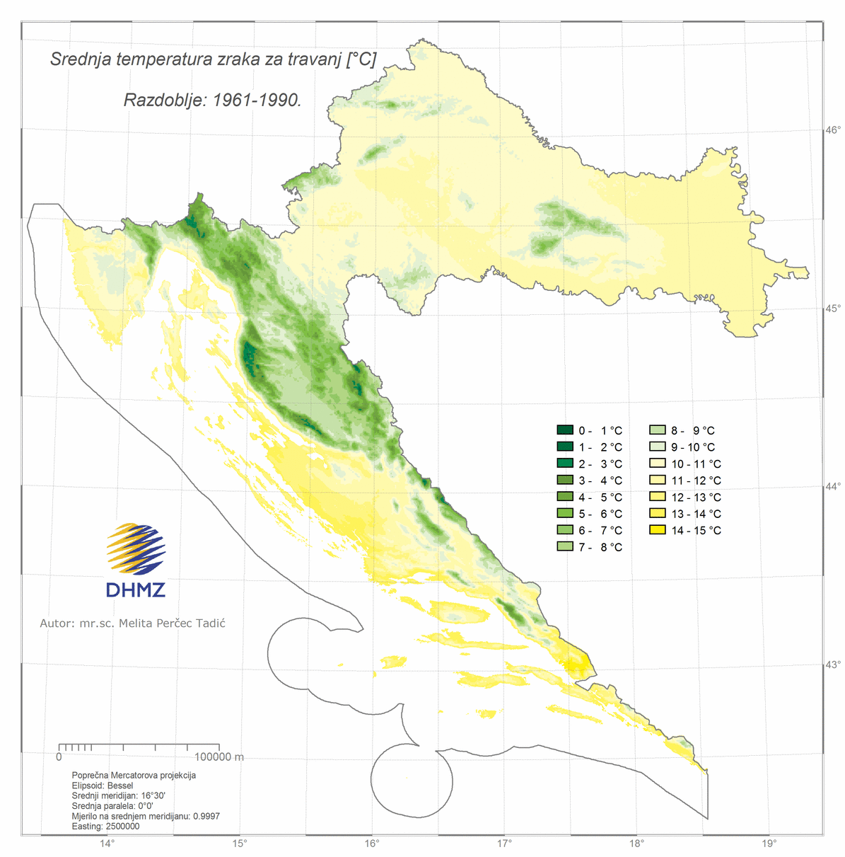
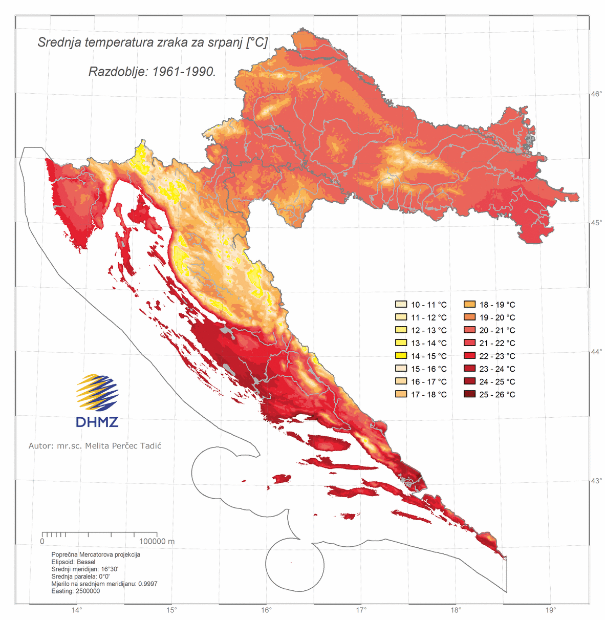
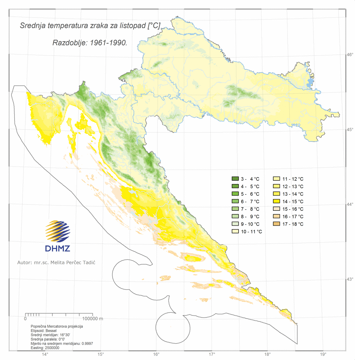
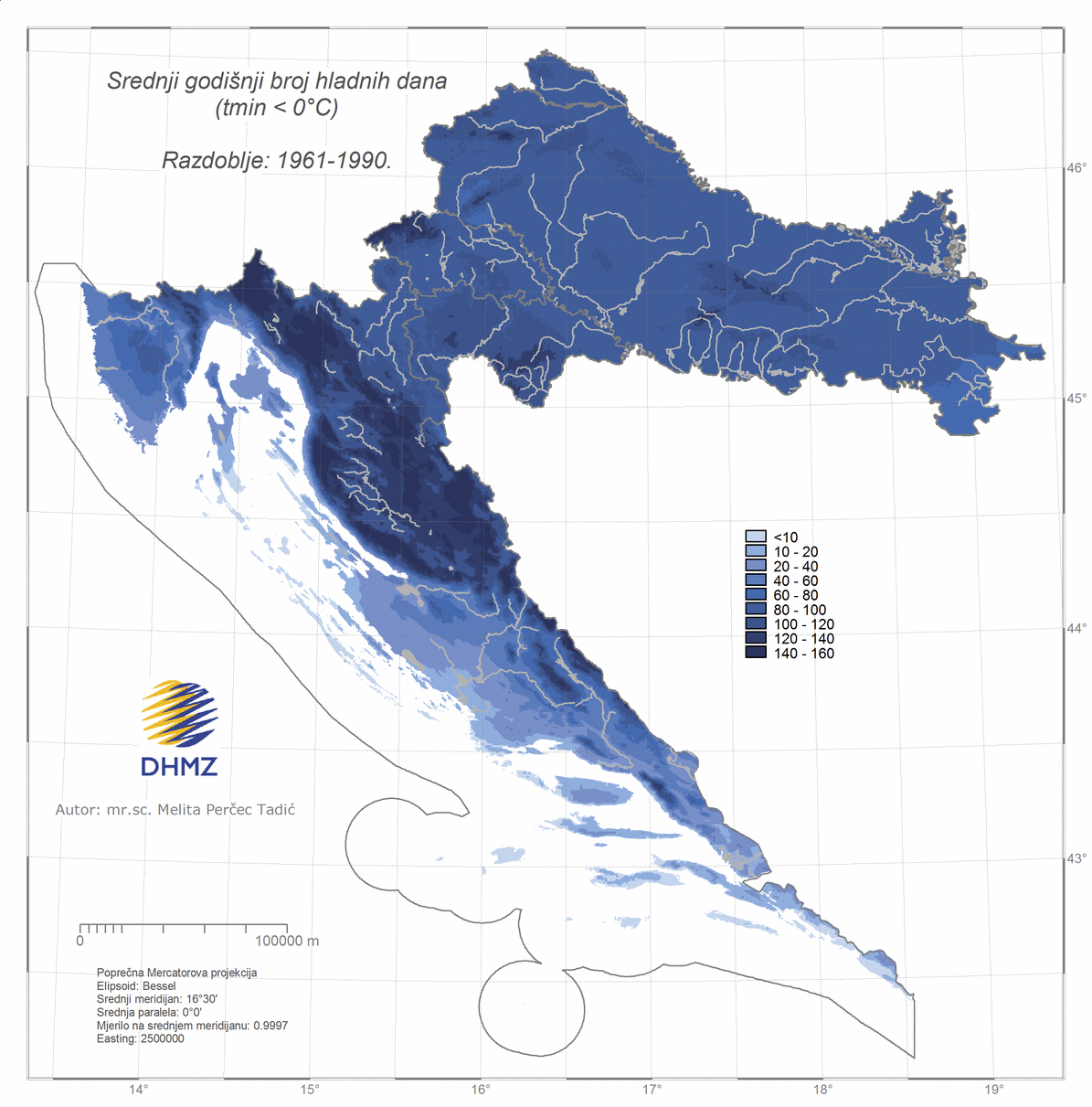
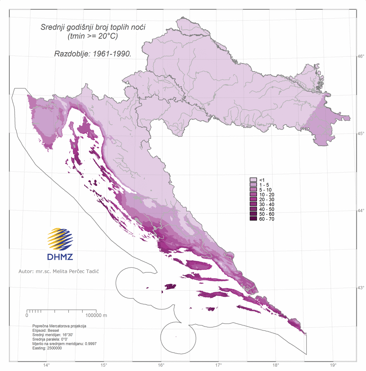
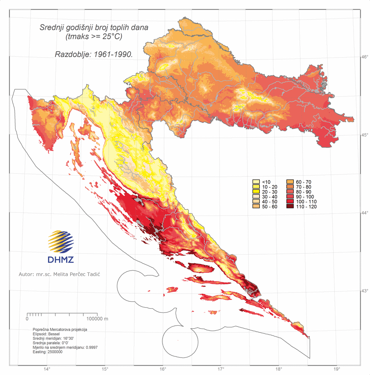
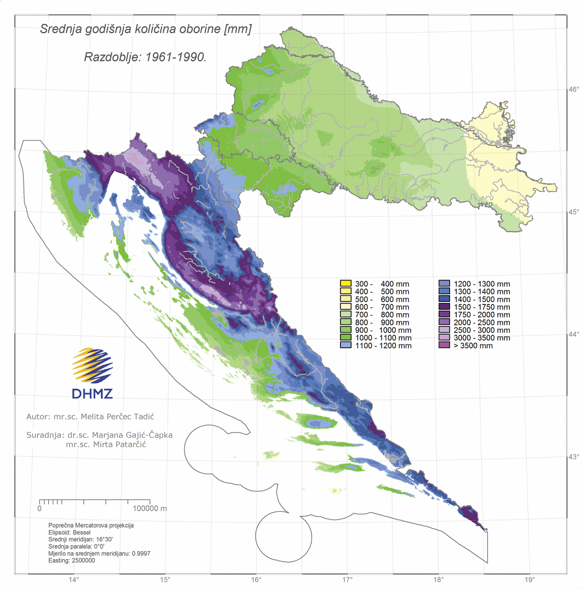
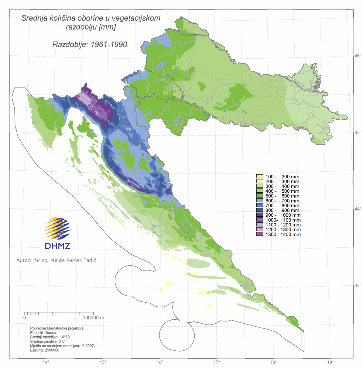
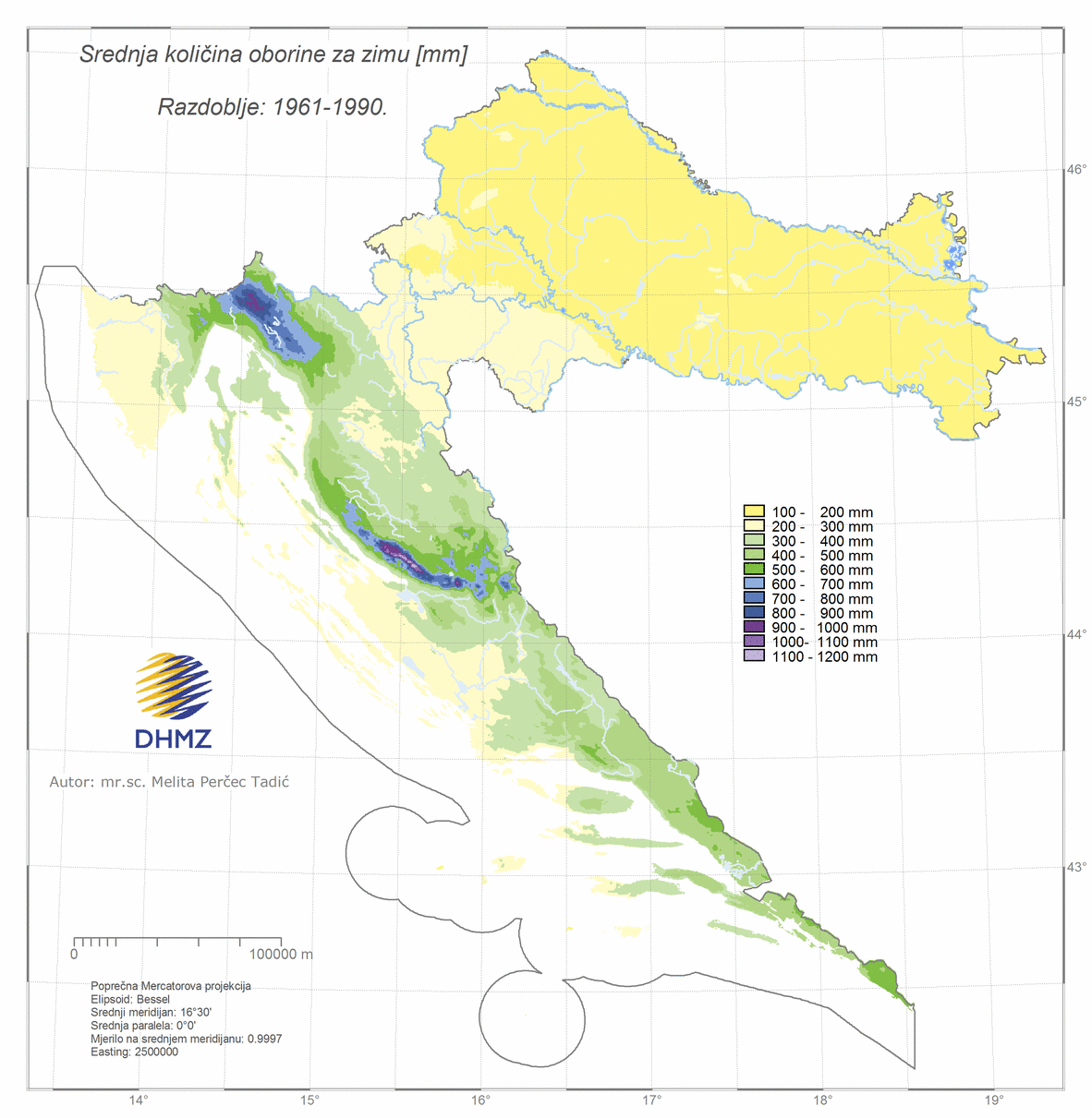
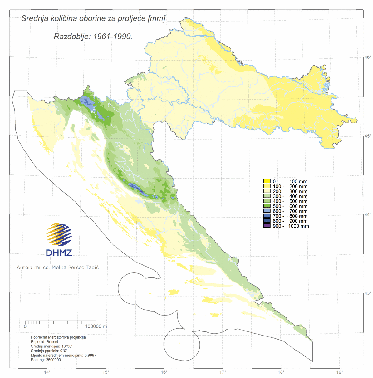
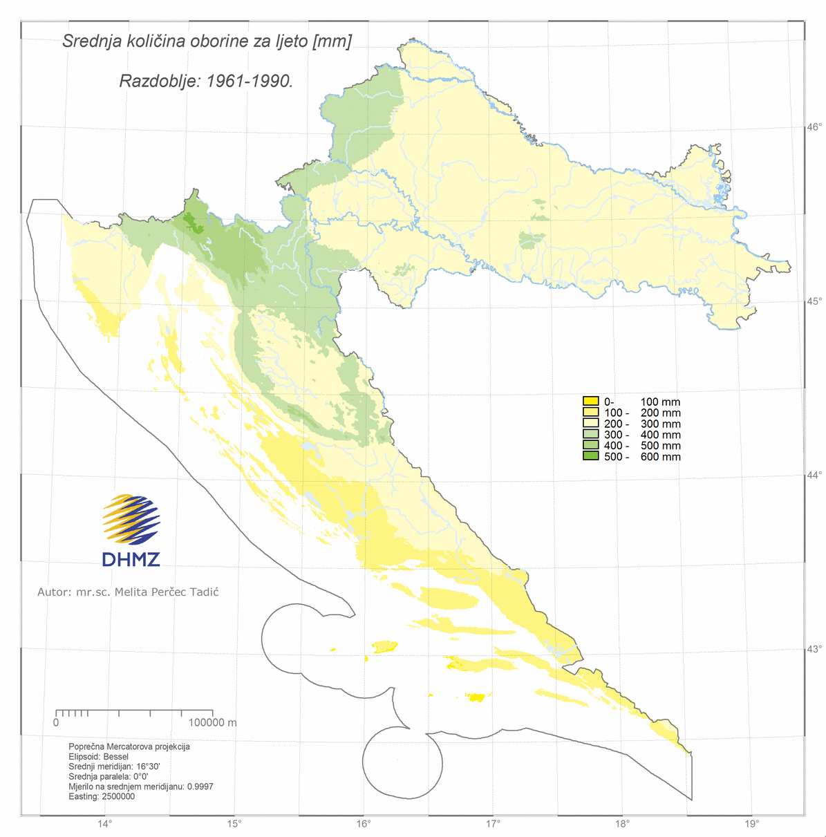
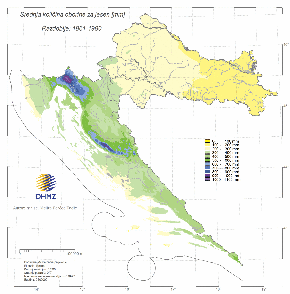
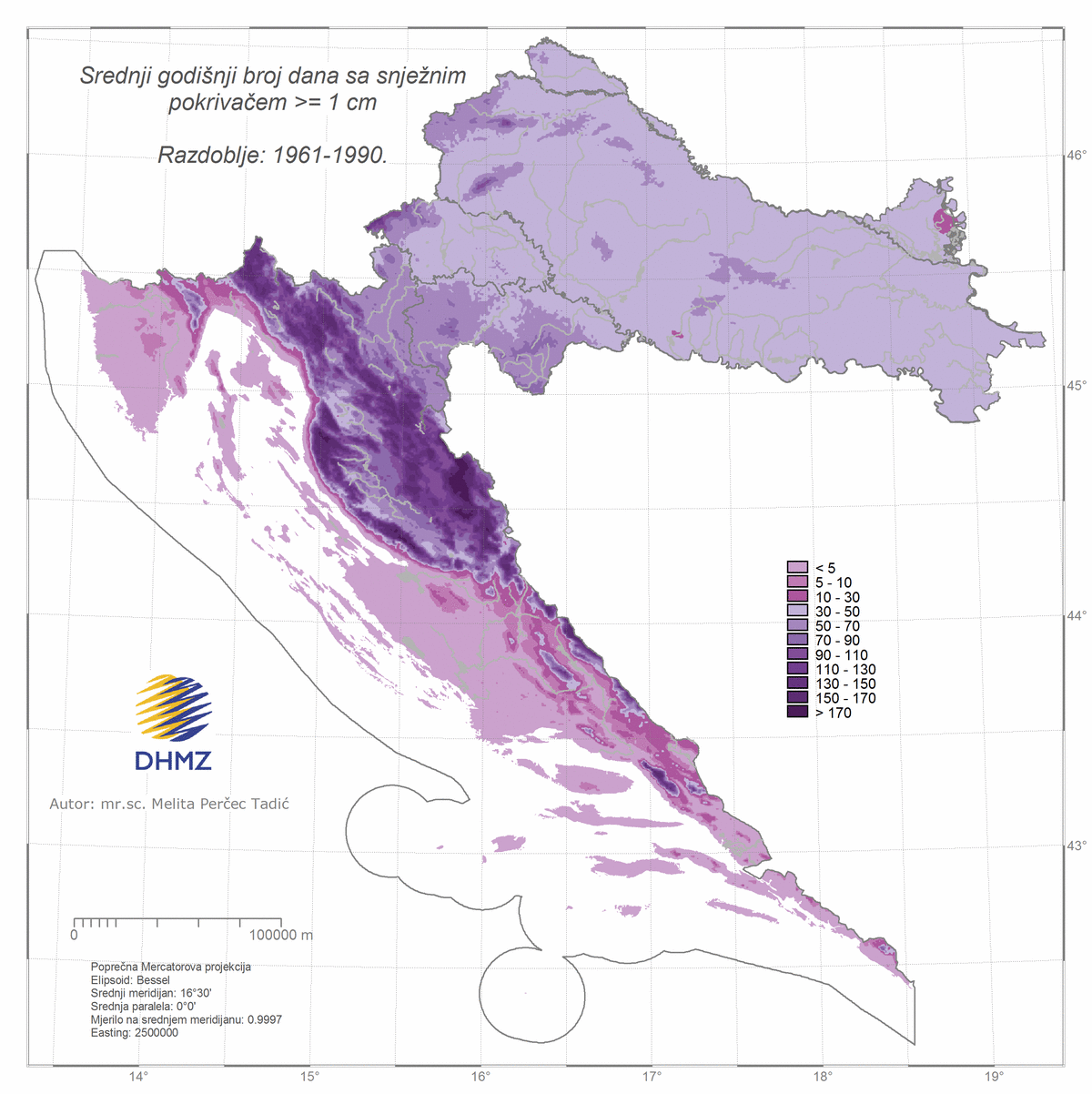
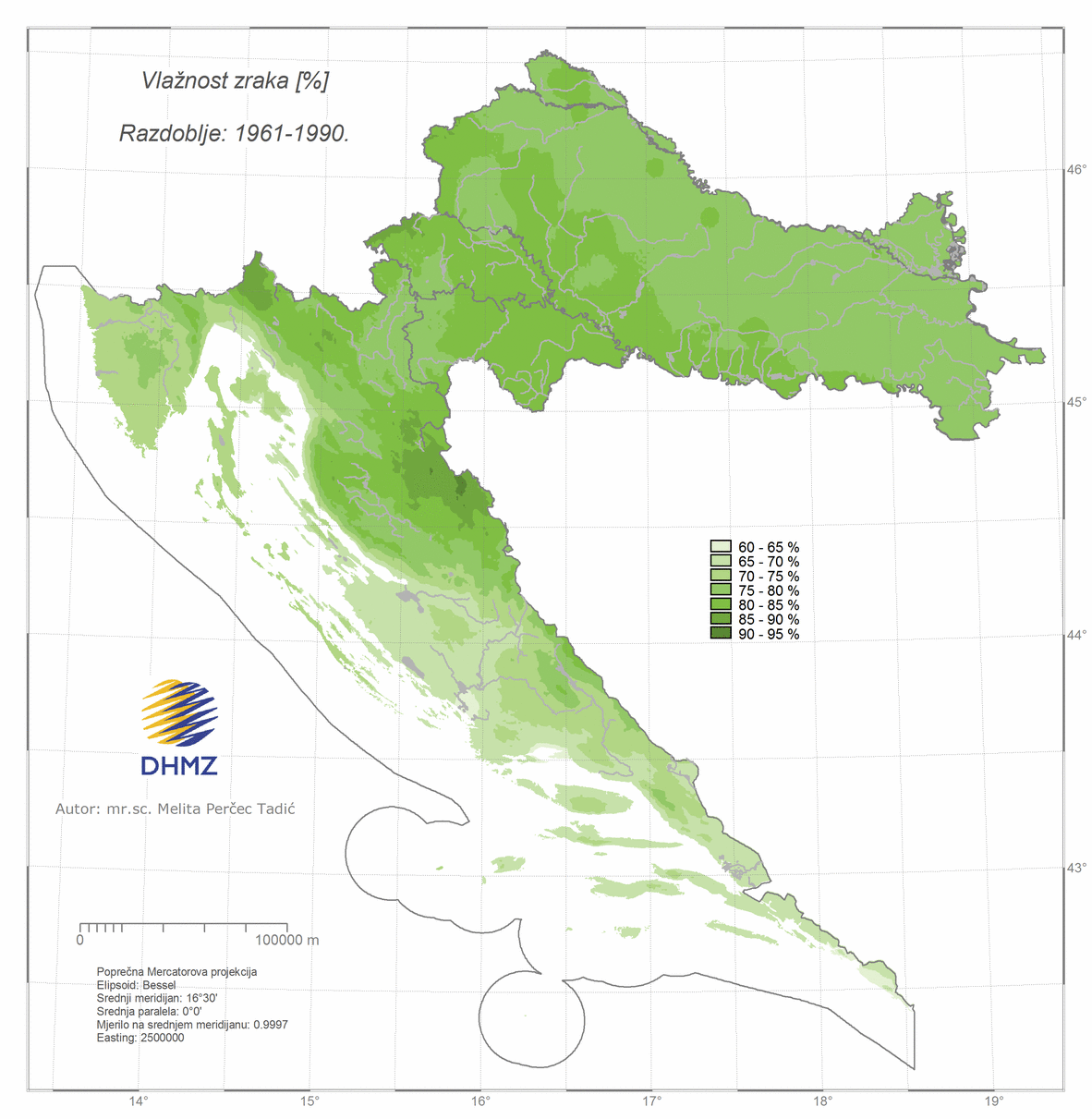
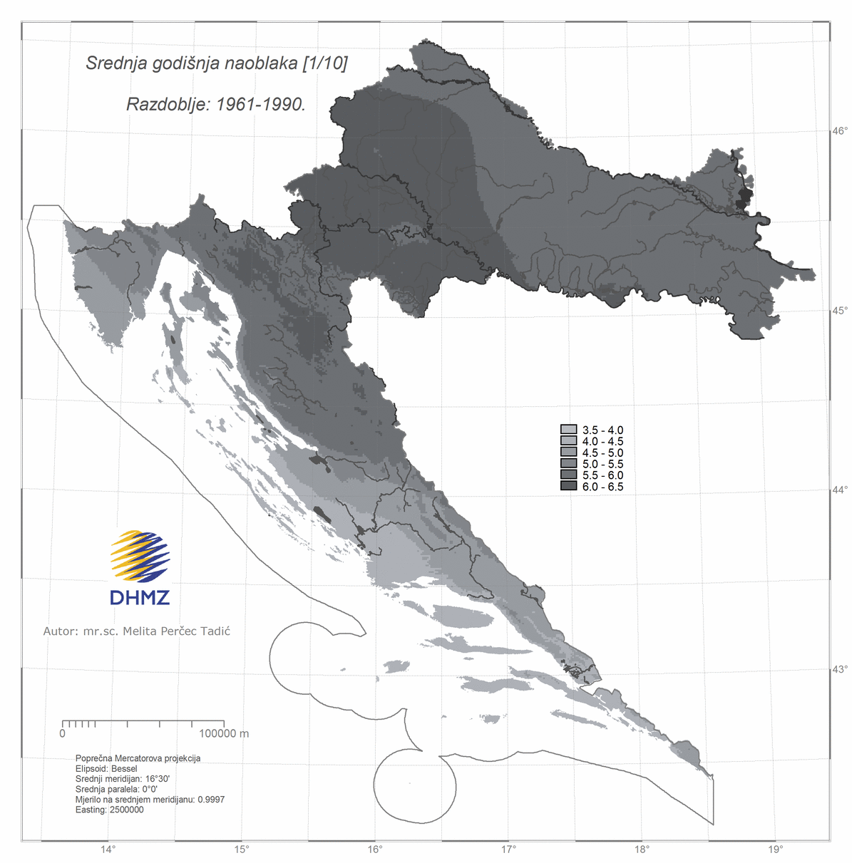
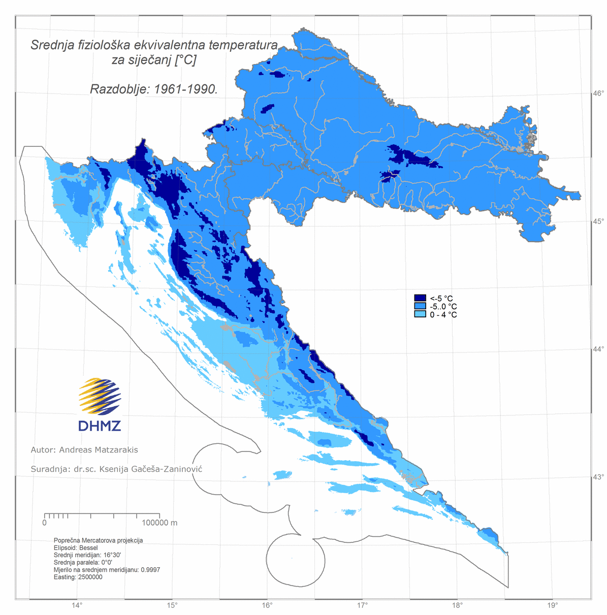
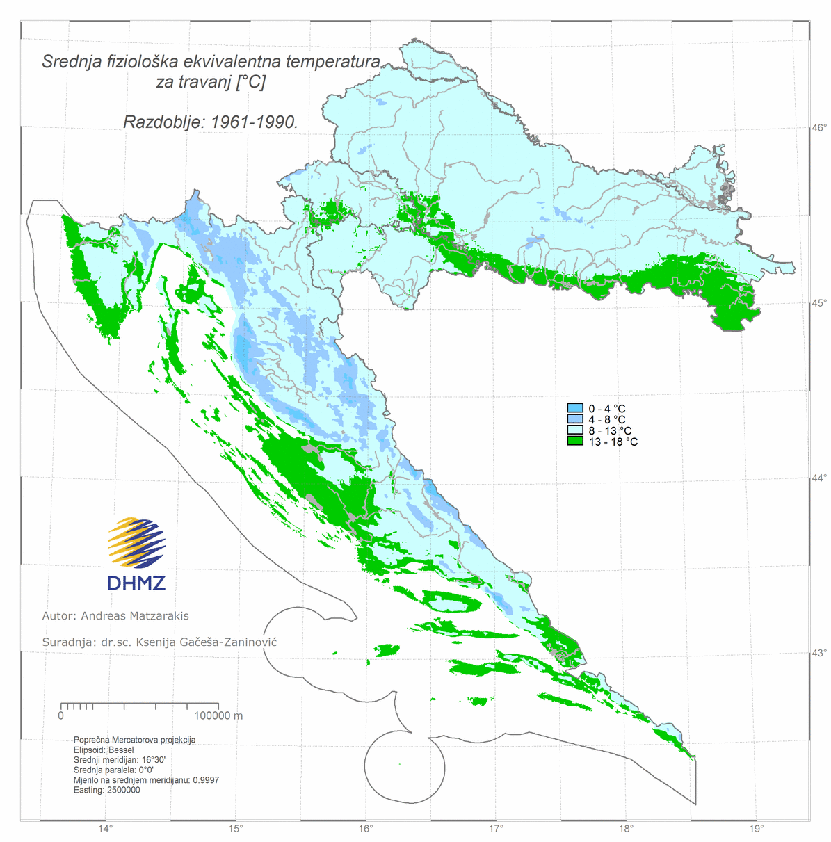
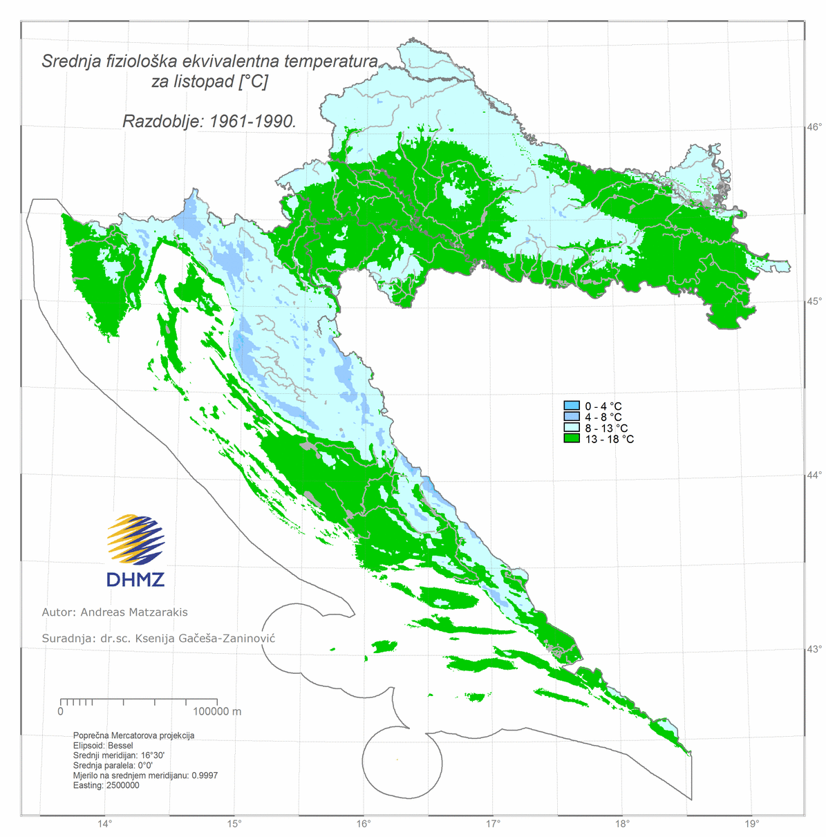
Maps, period 1961–1990
Daily observations and measurements of the climatic elements: sunshine duration, air temperature, cloudiness, precipitation, air humidity, air pressure, wind direction and wind velocity and others are collected on the meteorological stations. Based on such long term observations, climatic conditions can be assessed for the area of representativeness of an individual meteorological station or, by using the observation of several stations from a certain area, insight into regional climatic conditions can be given. The estimation of the value of each climatic element in locations where no meteorological observation is available is possible by using geostatistical mapping methods. All available observations are used for this purpose, generally over a period of 30 years, together with the influence of climatic factors on climatic elements that is taken into account. Climatic conditions are strongly influenced by geographical latitude, altitude, land and sea distribution, orography and surface type. The result of such geostatistical analysis is the representation of the spatial characteristics of Croatia's climate in the form of climate maps.
The most extensive such an overview can be found in the Climate Atlas of Croatia where the 24 maps of the most important climatic elements for the period 1961-1990 are presented.
In addition to these maps from the standard climate period 1961-1990, the data for the new 30-year period 1971-2000 are also analysed.
The maps are available in raster format ArcInfo ASCII and are issued on request and charged: [ doc ] [ pdf ].
The geostatistical mapping method and maps are documented in details in the Climate Atlas of Croatia 1961-1990, 1971-2000.